Monday, March 9, 2009

Gatun Lock


the last gate --in the lock next to us ----starting to close. the water has drained out and the ship left the lock.

pictures

outhouse in Santa Marta

Car carrier ship in lock

water filing lock


Gatun lock ---the last one we used with our tug in it waiting for the gates to open. You can just see the little split where the gate is opening

pictures


The bow lines. We usually have two. A few extras were added because of the strong winds in Santa Marta.
March 5 Fuerte Amador (Panama City), Panama
We had been in Fuerte Amador last year, going in the opposite direction and didn’t find much that interested us then so we decided to just look around the terminal building (for more gin, if the truth must be known).
Panama is very hot, the tender ride in was a bit rough and we didn’t stay long in the terminal.
The ladies from Fed Ex are on board so we decided to start the packing to see how much will be shipped to Florida and how much to Lochstead. We shipped five bags down and were under our 200 pound allowance so imagine our surprise when we only received shipping tags for four bags. I checked with the ladies and there in small print it said 100 pounds per passenger (in our cabin category) up to 2 bags. I guess we just got lucky when we shipped five.
Try sorting through things and putting them in suitcases in a little cabin not much bigger than a good size bathroom. Not fun.
Some folks went off on a boat tour (a small boat) of the Canal and the boat broke down. Not a good place to be dead in the water.
Our last folkloric show, the Panama Danzas Hoy. I think it is the same one we saw last year….at least the costumes looked the same.

March 6, Panama Canal Transit.
No matter how many times people go through the Panama Canal they are still excited about it and up on deck most of the time. For our third trip, we were no exception.
I’m sure everyone knows the story of the Panama Canal. The idea of digging a passage cross the isthmus of Panama uniting the Atlantic and Pacific Ocean goes back as far as Vasco de Balboa. The French and then the United States continued the idea. When the canal opened in 1914 the final combined cost was $639,000,000 but the toll in human lives greater. It is estimated that more than 30,000 people died from disease or accidents.
A few statistics for the interested:
Maximum dimensions of ships allowed:
Beam 106 feet
Length 965 feet
Draft 39.5 feet
Top Countries by origin and destinations of cargo
United States
Peoples Republic of China
Chile
Japan
South Korea
Ecuador
Peru
Mexico
Colombia
Canada
On December 31, 1999 control of the canal and the canal zone was turned over to Panama. Panama is doing extremely well: the canal’s income rose from 4769 million in 2000 to $1.4 billion in 2006. Accidents are down and traffic has increased.
Tolls charged vary---it costs almost a quarter of a million dollars for the Prinsendam to transit the canal.
If you want to read more about the history and construction of the canal, David McCullough has a wonderful book The Path Between the Seas.
We began our transit about 7 am. Waiting on the docks between the locks were the ship’s photographers who had been up since 4 am to get off onto the pilot boat.
Things went smoothly with only a few delays as we waited our turn and we exited the Gatun Lock just at dusk.
We had been told that webcams were stationed along the canal so we quickly e-mailed family and friends to watch the Prinsendam go through. Kenneth told us he would be watching the starboard stern for us at the last lock. Alan and stood there (in the rain) for an hour, waving like fools. Every time I waved at what we thought was the camera the man operating the mule (towing locomotive) waved back. I wonder what story he had to tell when his shift ended.
The Prinsendam provided a great commentary all the way through the passage. If only we could have it in print.
Alan swam the Panama Canal, in the Lido pool. Five more Dam Dollars.

March 7, San Blas Islands, Panama.
Rough seas delayed tender operations but we finally made it to shore on one of the larger San Blas Islands. There are 365 of the San Blas Islands located just a few miles off the Caribbean coast of Panama. Some of them are inhabited by the Kuna Indians who still live in simple thatched roof huts and wear their colorful, traditional outfits, including the now popular world-wide molas. About 50 of the islands have permanent communities.
Some are just tiny specks of sand with a few trees.
Mola means blouse, and they are made by the women in this martriarcal society . Molas are hand made and consist of a number of different pieces of cotton cloth laid one on top of the other. The maker cuts down through the layers forming primitive designs of natural figures such as birds, fish and frogs, as well as mythological or geometric patterns. The layers are then sewn together with incredibly tiny and intricate stitching. They are then used on clothing, purses, pot holders and framed.
Molas used to be a great buy until one of the larger upper end department stores discovered them, bought up a tremendous supply and featured them in their Christmas catalog. The Kuna Indians caught on that they had a very marketable products and prices soared.
The Kuna live much the same as they did hundreds of years ago with the exception of cell phones, electricity and TV. The main street in the village is about 10 feet wide, made of packed dust, and lined with small thatched roof huts. The huts I was able to peek into were bare of anything but a table or two, and a couple of hammocks. Small dirt alleyways with more huts lead off the “main street.” It is very simplistic life but when you see a woman dressed in a colorful skirt, mola blouse with a yellow or red scarf on her head, a ring in her nose, and a black stripe down the center of her face talking on a cell phone you feel like you are in the twilight zone.
In the center of the village was the town square, a tiled floor surface with more huts around it. The molas of all sizes from 3x3” to 2’x2.5’ hung on ropes outside of each hut. Some were crudely made and others with very fine stitching and design.
A couple of huts advertised cold beer. I have never seen so many little kids in my life. Or puppies or kittens. The kids who couldn’t crawl were in wash tubs at their mother’s feet while Mom sold molas. Kids a year old and up ran around in the dust, playing like kids do. Each kid who could talk had mastered “one dollar” very well. Poor little kittens were dressed in doll clothes and held up for pictures. One dollar.
I spent more than a few dollars for molas and then asked the woman if I could take her picture. She replied, “one dollar.” I should have made that part of the deal before I handed over my money. Other passengers had the same experience.
The huts built right along the shoreline had a little walkway/pier out to a tiny hut over the water. Yep, those were the outhouses, with “plumbing” that went directly into the water.
We caught the last tender back to the ship….a rather rough ride….and set sail for Santa Marta, Colombia.


March 8, Santa Marta, Colombia Day 66
If they published one, the ship’s newspaper could read
CRUISE SHIP BATTERED BY GALE WINDS.
With winds at 50 knots, gusting to 80, seas and swells up to 19 feet, the valiant Prinsendam made her way slowly toward Santa Marta, Colombia from the San Blas Islands. It was the Prinsendam's first stop every at the Colombian port.
The high winds began yesterday as the ship was anchored in the San Blas Islands.
At one point tender operations had to be halted as the Prinsendam dragged her anchor.
Because of sea and wind conditions the Prinsendam cruised at under 14 knots all night and consequently was several hours late arriving in Santa Marta. Some of the longer tours were canceled but most tours went as planned....just a few hours later than expected.
As the Prinsendam entered the harbor she was greeted with the sight of a Chiquita banana boat at her dock. Tugs soon moved the banana boat (we’re talking a large container vessel, not a Harry Belafonte type banana boat) to another dock and with great seamanship, the Captain docked the Prinsendam in 30-40 knots of wind. Extra lines were put out and the gang way lashed into place with additional lines.
Although barf bags were put out yesterday, warnings continually broadcast to stay inside, and seasickness pills dispensed frequently, there were no injuries and only a couple of falls.
It was a very rough night, and an even rougher day. People in the Crow's Nest Lounge on Deck 12 reported spray washing over the windows. This morning all decks, railings and outside stairways are white with salt. Two windows in the Ocean Bar Lounge shattered as well as one in the dining room.
More of the same weather is predicted for the next two days, as the elegant Prinsendam
makes her way to Fort Lauderdale, Florida. In spite of the delays and being uncomfortable, the hardy mariners on board are still smiling and enjoying the last four days of the cruise.
The end
As I was sitting writing the above we hit a wave or a wave hit us and I literally bounced off the little stool I was sitting on to use the computer. At 2pm, just after we left San Blas, the Captain announced that we were sailing in a gale and could expect gale winds, high seas with swells up to 15 feet.
Our cabin is on deck 5. Deck 4 is the first one about the water line and has no passenger cabins so you can see we are pretty low in the ship. The waves were splashing up over our window. I would never, never, never, get a cabin any higher than we are. Funny, how the most expensive cabins have the most motion. They are larger, and probably very nice on calm sea days but I wouldn’t take a chance even if we could afford the penthouse.
We had several announcements that the ship was bouncing "violently" and to be sure and use the hand rails.
Dinner was a challenge. Just after we were seated a very powerful lurch occurred and water and wine glasses on several tables went flying. We were lucky and only lost a glass of water. Several guests at other tables were drenched in wine.
As dinner progressed we all became very adept at eating with one hand on the wine glasses. Occasionally we would relax but as we felt a pitching motion coming, eight hands simultaneously reached up and grabbed the glasses. It was probably the most fun dinner we have had.
Remember the photo contest? Well, guess who won First Place in the people category. No, not Alan. My portrait shop will open when I return to real life. The prize is the Antarctic Wildlife DVD. Be prepared to watch one hour of penguins and seals.
Alan went on a Cruise Specialists tour and I wandered the small shore front which housed a few stalls of handmade goods.
When I returned back to the ship (having been almost blown off the pier getting there) I went up near the bow to take a picture of the many lines holding us to the pier. As I snapped the picture, a security guard came up and by gestures told me to go back to the gangway as I would be cut in half if a line snapped.
Two sea days and it’s Ft. Lauderdale and the end of our journey.

Friday, March 6, 2009

Catch up March 1 --4

March 1, Salaverry/Trujillo, Peru
Salaverry is the third most populous city in Peru and the capital of the La Libertad Region. It is also the port of call for people who wish to visit Trujillo in northwestern Peru.


"houses" on the side of the road going from the dock to Salaverry.


Trivia note: Peru is the world’s leading asparagus exporter and much of it goes through Trujillo.
A very comfortable double decker bus provided a shuttle to Trujillo Major Square in the center of Salaverry. It was a lovely square, surrounded by old mansions, the cathedral, and several business. The large statute in the center was under renovation and “roped” off with tall green screening. Too bad, the pictures would have been nice.
We entered the church where Mass was being held. I couldn’t recognize the song they were singing until someone said it was I’d rather be a hammer than a nail. The church was very crowded, something we don’t often see. But, this was a Sunday and it’s a very Roman Catholic country.
Alan hired a cab and went off to see the ruins at Chen Chen, as well as the temple of the sun and temple of the moon. After wandering around for about a half hour I hooked up with four ladies from the ship who were being escorted to the local market by an armed guard. It seems they showed him their map, pointed to the market, and he decided to take them there himself.
The market was the typical local market with plenty of fish, meats and vegetables. There were plenty of stalls with kid’s clothes, as well as adult clothing, and many with underwear. After searching unsuccessfully in several ports for a camisole to wear under an eyelet top, I found a man outside the market on the street selling men’s undershirts/
The ladies said, offer him a dollar, I did. He gave me an undershirt. It worked fine and I finally wore my new top bought weeks ago in some city in Brazil.
When he saw my undershirt purchase, Alan wanted to know why I didn’t buy a dozen.
We tried to have lunch at a nice looking hotel but the dining room was closed so it was back on the bus and back to the dock.
Several stalls/vendors had set up shop on the dock so I picked up a couple of necklaces made of local products.
Alan made the next to last shuttle after a successful trip to the archeological sites of the area.
Before we sailed we were treated to another “afternoon of local cultural entertainment.”
Most of the dances of this part of the world involve a great deal of waving of white handkerchiefs.
March 2, At Sea in the Pacific.
The newest group of speakers continues to give talks on the Panama Canal, Ecuador, and Spanish lessons continue.
One of the Explorations speakers is a former Rockport, MA neighbor of our friends Penny and Larry Olson. Small world,
Tonight was the final “dress ball” of the voyage, the Black and Gold Ball. Streamers, balloons, gold sequin tuxedos on the waiters, guests in gold and black all made it a festive occasion. There will be a couple more formal nights, but no more balls.
March 3, Manta, Ecuador.
I think Manta was on the itinerary so people could go to Quito and stand on the equator but so few signed up for the pricey excursion that it was cancelled. We stood on the equator a few weeks ago in Macapa.
Manta is an interesting city in its own right. It has a population of over 250,000 and has the largest seaport in Ecuador.
Contrary to the name, Panama Hats are not from Panama but originated in Manta. There are panama hats for sale everywhere! At every price from $5 to thousands. Yes, thousands. Dollars, not pesos. The US dollar is the official currency of Ecuador.
It is believed that when Teddy Roosevelt went to Panama he saw the hats (which had come over from Ecuador) liked them, bought a few for friends and took them home saying, look what I bought you in Panama. Hence the name.
Hat making is a cottage industry although there are factories which mass produce them. Reeds or grasses are boiled in water to soften. The softened strands are then pulled apart into long strands which are then woven into the hats. A very good, very expensive panama hat should last for years and may be tightly rolled up and kept in a wooden coffin shaped box.
Another interesting product of Manta is buttons. Supposedly, most of the world’s buttons are made in Manta. Two of the three button factories have closed but one is still going strong.
The buttons are made from the tagua nut which is also called vegetable ivory. The "nuts" are really seeds and are about the size of a chicken's egg. The nuts grow very hard and can then be carved into small statutes, little cups, chess pieces, key rings and buttons.
To make buttons the nuts are sliced into the shape and size needed and then colored with vegetable dyes.
Some of the carvings were very intricate, and of course some quite simple.
After exploring the artisan’s market place in downtown Manta, we hired a cab and rode out to the nearby city of Monti Cristo, supposedly to visit a Panama hat factory.
It is pretty much the same in whatever country we visit. Someone who speaks pretty good English hustles (and hassles) customers and negotiates the price. Then a second person (usually “my brother”) appears and leads you to the cab around the corner . The air conditioned cab promised almost always turns out to be air conditioned by opening the windows.
Manta was no exception but “my brother” the driver was personable and friendly so off we went. The “factory” turned out to be a small shop with a woman sitting on the steps weaving a Panama hat. Needless to say, Alan was not happy. Not at all happy. So off we went to the top of a mountain to see the view of Monti Cristo, more buttons and tagua nut carvings, and the local church
On the way back to the dock we passed the symbol of Manta, a 50 foot model tuna. Tuna fishing is now the main economic activity in Manta, with large commercial fishing boats complete with helicopters for spotting lining the harbor. Smaller, older, traditional fishing boats also fill the harbor. We knew when we passed the tuna processing plant, a rather odorous place.
We had the cab drop us at the supermarket where I bought a can of tuna fish to see if there is any difference. Premium white in water --$1.07. A hot 15 minute walk ---finally a walk downhill) took us back to the dock and the shuttle out to the ship.
While waiting for the shuttle we observed 50 or so Volkswagons of various models being driven off the dock parking lot ---off to the dealer we guessed. Tied up along the Prinsendam was a strange looking ship….very high with no ports, cranes or markings…that someone said was an automobile cargo ship. Wish I’d gotten a picture for confirmation. (We're in the Panama canal as I'm posting this and I got a picture of a similar ship. Will post it later.)
After lunch, I decided I wanted to go back to the market place and buy silly, useless gifts for the grandchildren. Something else to pack. They will have to wait for Camp Grandma 2009 for them.
So many of the places we’ve visited have been very poor. We’ve been told not to give to the beggars. It’s hard not to but Alan gave money to a kid in a wheelchair and didn’t even get a smile. We gave chocolates to a couple of kids, and watched them run off without an acknowledgement, eat the candy and throw the wrappers on the ground. None of the passengers expect anything from these kids but all wonder if we’re doing them any favors. I know they are poor and some not healthy, and I may be cynical but I think they practice the sad face for the tour bus arrivals.
March 4, At Sea We crossed the equator again last night.
Yesterday afternoon I gave the picture of the “garbage men” to the dining room hostess to give to them. Tonight at dinner, she brought one of them into the dining room as he wanted to thank me. I don’t know how many rules were broken as you never see the below deck help on the passenger decks but I think she went to extra mile to make the fellow happy. The crew on the ship are wonderful, from the deck officers to the men painting the sides in port. They are all away from their homes and families for months but are always cheerful and helpful.
Alan and I spent a portion of the day trying to earn Dam Dollars. Two or three times a day on sea days, “sports” activities are held and each participant receives a monopoly money Dam dollar or two. We’ve never bothered with Dam Dollars but we each earned five for the equator swim and that got me started. I decided I wanted a cap…..valued at $30 Dam Dollars. We did the Antarctica swim….five more each. Then a couple of golf putting games. Believe it or not I won six in golf putting. We passed the 30 goal so I decided to go for a 45 dollar beach towel. Passed that. Decided to go for 60 for the sweatshirt. Yesterday we earned enough for the sweatshirt so we’re calling it quits.
Halfway through the cruise some people had over 200 Dam Dollars…..let’s get a life folks. But it’s fun and you met people so we can’t knock it.
Tomorrow Fuerte Amador, Panama. We’ll be there from 7 am until 2:30 am the next day(Friday). Then we pull up the anchor and head for the entrance to the canal.

Thursday, March 5, 2009

Feb 21 to Feb. 28

this is the area around the temples in Peru. Pretty desolate country.


I know, I know. I am very far behind. However, I have an excuse as I’ve been operating at about 20% capacity due to a lousy cold and cough. It’s a good thing Florida doesn’t have a quarentine or they wouldn’t let me in. If it was Ellis Island of the old days, I would be sent back to somewhere. Antarctica?
This is a great deal to read. You can skip it and I’ll never know
.

February 21, At Sea in the Pacific Ocean
This morning was the back of the house tour. Groups of about 20 left the Queen’s Lounge every 10 minutes until all 340 who signed up had toured the galleys, crews mess hall, etc.
Now would be the time to tell how many dozens of eggs, bottles of wine, pounds of lobsters, and so on the passengers consume but I don’t remember so I can’t tell you.Maybe someone will have the figures later.
As we went through the swinging doors from the atrium on deck 4, the carpeted floors gave way to tile, the paneled walls to metal and stainless steel and the fancy lighting to utilitarian. The various “shops” were off a long corridor. We saw the pastry shop (and sampled cookies), the butcher shop where two butchers were cutting up a side of something, the shop where crew members were making huge vats of soups, and a shop with hundreds of salad plates garnished with greens and ready for fruits slices to be placed on them.
All the prep work is done in the galleys on deck four and the plates and containers then taken to the kitchens on decks 7 and 11 for assembling and finishing.
We visited the crew's mess hall. It was a pleasant place with tables for 6, 8 and 12. The room also contained a couple of TVs, some computers for games, computers for the internet, and a few comfortable chairs. Service in this area is cafeteria style.
Further down the corridor we passed the garbage and recycling rooms. The Prinsendean and probably all cruise ships are very “green” conscious and recycle everything possible.
Recycling starts in the passenger cabins where we have an attachment for paper hooked to the waste basket. In the dining rooms the bus boys and waiters clear the tables and then sort the contents of the trays in a room just off the dining room. Left over food goes into yellow bins, paper and metal into grey bins, and glass into blue.. Below deck, in the garbage area, the bins are again sorted, using the same color scheme.
Paper is then compacted. Glass crushed, metals recycled and food stuffs go into a “blender” where it is liquefied. At varying times and in varying locations the liquefied food stuffs are emptied into the ocean where it becomes food for the sea life.
Standards are very strict and once a food enters the dining room it is considered waste. Breads not eaten are not made into croutons, left-over strawberries are not made into jams, or pats of butter used in sauces. The amount of waste is staggering.
Also staggering was the amount of wine and liquor originally in the provision storage area. It was pretty much depleted by now but according to the man in charge, at the beginning of a long cruise the cases reach the ceiling and spill out into the hallway.
Today we continue our journey up the long coast of Chile. Chile is quite a mix of climates and landscapes.
The central region is fertile and contains orchards, vineyards and sheep and cattle ranches. Most of the country’s population live in this area and the main cities are located here. In the north is the Atacama Desert, one of the world's driest areas. The south contains the fjords, islands and glaciers. To the east are the Andes, marking a fault in the earth’s crust which causes frequent volcanic eruptions and earthquakes. It is said that there is at least one earthquake a day in Chile…most of them hardly felt.
A little bit about the Atacama Desert.
The desert lies mainly in Chile and Peru and stretches along the west coast of South America from the equator to about 20° latitude for approximately 1875 miles. It is rarely more than 125 miles wide, the distance between the Pacific Ocean and the Andes mountains, its natural boundaries. The Andes, which rise more than 19,700 feet, block the passage of moist winds coming from the east. Running up from Antarctica is the Humboldt Current which along with the cold air above it creates a thermal inversion. The thermal inversion dries the air by extracting moisture and condensing it into insubstantial mist. Sometimes stratus clouds are formed in the higher air layers but these clouds produce no rain, making the Atacama the driest location on earth. Arica once went with rain for 14 years.
As everyone knows, the native South American people, including the Incas, were conquered by the Spanish. In 1818 a revolution led by a Chilean with the unlikely name of Bernardo O’Higgins overthrew the Spaniards. The country was in military and economic turmoil off and on until 1990 when Pinochet’s military regime was ousted and a democratically elected government restored.
February 22, Valparaiso, Chili
Once again the elegant Prinsendam, as the cruise director likes to call it, is docked at a commercial port, sharing space with freighters, tugs, cranes and containers.
And once again, we’re in a city with port facilities along the waterfront and businesses and residential areas clinging to hills that rise abruptly from the shore. The are no less than sixteen funicular railways to get folks up the steep hills.
We are here on a Sunday but a large mall a short walk from the dock entrance is open so we venture over to pick up some cold medications for me. I think I am one of the last to come down with a cold and I’ve gotten it with a vengeance.
Because this is a commercial port, we had to be bussed a couple of miles from our dock to the terminal, a large metal building with a couple of shops in it.
It was an adventure crossing several major highways to get to the mall ----especially since there was a bicycle race through the town with special traffic control people stopping pedestrians from stepping off the sidewalks and being run down by the racers.
My second adventure was trying to get cold medications from a pharmacist who spoke no English. Who knows what I am taking?
The dock section was a tad seedy and given that I didn’t feel like hiking up hills, I went back to the ship and Alan continued on.
After a bowl of soup, I took the laptop into the terminal and for $2 had an hour to check e-mails and post pictures on the blog. Unfortunately, in my haste to get back to the terminal I deleted several days worth of blog.
A stand in the terminal also sold telephone cards ----90 minutes for $5. I took advantage of it, sat in a comfortable chair and called the kids.
A shop in the terminal sold wine and bottled pisco sours so we now have a bottle of pisco sours. They are the national drink of Chile (Peru claims the same thing) and are made from pisco (a regional brandy made of Quebranta or Muscat Grapes), lemon juice, egg whites, simple syrup and regional bitters. Our port lecturer claims that three will knock you right out. We’ll see.
Tomorrow, Coquimbo. Who has ever heard of these towns?
Feb. 23. Coquimbo and La Serena, Chile
The port city of Coquimbo, along with neighboring La Serena, have a population of more than 300,000. Pretty small compared to many of the places we have visited. Coquimbo is an industrial and shipping center while La Serena is a beachside resort town.
We hired Pedro and his taxi for three or four hours and after seeing the Fuerte de Coquimbo ---a small fort at the harbor entrance, drove the 10 or so miles along the waterfront roadway to La Serena. We arrived at the end of school vacation on a cloudy, cool day so the beaches were pretty much deserted. The most activity was a soccer camp practicing on the beach in front of El Faro, the lighthouse.
The drive was a typical beach town drive, small hotels on one side of the road, the beach on the other, restaurants with outside seating and a few cottages. And wind. And stinging sand.
Pedro parked in La Serena and Alan and I wandered the town. I don’t think I will ever get used to the noise of the cities and towns in South America. Every block or so has a musician playing on the sidewalks, two, three and four piece groups performing on the corners, loud speakers blasting music from each and every store. A group playing in the Plaza de Armas (every city and town has a Plaza de Armas and an Avda O’Higgins) was so good we bought their CD.
We traveled back to Coquimbo on yet another stretch of the Pan American Highway, spent some time there and then returned to the Prinsendam.
February 24 At Sea, steaming up the Chilean coast toward Arica.
I don’t have much to write about as I spent almost all of the day in bed, barking like one of the sea lions we saw in Antarctica.
The dining room (and the staff) were colorfully decorated for Mardi Gras and Mardi Gras beads and silly hats were given to everyone. The waiters are so good natured about getting dressed up in sequins and Liberace type outfits.
The ship has announced a Grand Voyage Photo Contest. Passengers are being encouraged to submit the best of their photos…you are allowed one in each of three categories: Landscape, Wildlife and Portrait/People. You may not touch up the photos, and the photo department takes them off your memory card. There is a charge of $5 per entry and you get an 8 x 10 of your photo to keep. Balloting will be done by the passengers sometime next week. I am going to enter the shot I took of the crew members in the open doorway of the ship. I don’t know if I mentioned that they are the garbage men and I had hoped to have a print made to give to them. I had no luck having a print made (you had to have a minimum order of $12) so this is my way to get a picture for them. Our assistant dining room manager has promised to get it to them.
February 25, Arica, Chile
Arica, our last port in Chile, is only eleven miles south of the border with Peru. Until 1880 it was part of Peru when it was taken by Chile during the War of the Pacific.
Nearby is the Potosí silver mine --the largest silver mine of its kind in world history. Because of silver being shipped from Arica, the area became a hunting ground for pirates such as Sir Francis Drake, Thomas Cavendish and Simon de Cordes. Legend has it that Drake's treasure, estimated at ten billion dollars in gold and jewelry is buried near Arica.
IT’S HOT AGAIN.
Once again, we were bused out of the dock area to where we only had to cross a street to be in a pretty little park lined with stalls of souvenirs and sweaters. Dominating the park, the town and the dock area is a large, (very large) hill with a fort and military museum on the top. The hill looks like an excavation site in a sand pit but is actually gravel and rock. Since there is next to no rainfall in Arica, there isn’t much chance of landslides.
Arica has a very pretty church designed by Eiffel, of Eiffel Tower fame. I believe the church was constructed in France, shipped to Arica, and reassembled.
We walked to the commercial district in search of a place where I could get my hair cut.In what was called the mall, a main street with a series of small alley-like streets running off it, we found an entire alley way of uni-sex haircutting shops. I picked out one, and since they didn’t speak English and I don’t speak Spanish we managed to establish that I needed a haircut. For 4,000 pesos, (about $6.50US and that includes the tip) I got a great haircut. In desperation about three weeks ago I paid $69.00 on the ship for a lousy hair cut….really lousy.
Alan wandered off to go up to the military museum and I wandered around the city, ending up at the Mercado Central where everyone was buying sweaters and jewelry. I can’t tell what I bought but I’m pleased. I know what I bought but I can’t spoil the surprise for someone.
February 26, At Sea
Another lazy sea day. After Antarctica everyone seems to be just hanging out and relaxing.
February 27 and 28, Callao (Lima) Peru
Once again, our port lecturer has warned us on how to act in Lima, (try to blend in), what to wear (dress down), what not to wear (leave the jewelry on the ship, and what to do if someone grabs your purse or watch (let them go). I’d like to know how a bunch of elderly, white haired, fair skinned, bent over grandmothers and grandfathers are going to blend in with black haired, dark skinned, stocky Peruvians. Not to mention the cameras that are around everyone’s neck or wrist.
In any event, we’re back safely after two days of Lima, none the worse for wear. We took Frank’s warnings to heart and were able to pick up a second tour from Cruise Specialists. Actually, since they can’t sell tours on board, we bought tickets from two of their passengers who weren’t able to use their tickets.
A bit of background you probably don’t care about.
Lima is the largest city in Peru and its capital. It is the fourth largest city in South America. And very poor! Out of 8 million people, 50% of them are classified as poor….not poor as in only have two televisions, one cell phone, an old car and hand me down clothes but poor as in living in shanties and barely having enough to eat.
Lima is divided into several districts. Among them, Callao is the port area and the poorest. Centro is the historic district and contains the Presidential Palace, and St. Francis Cathedral. Miraflores is wealthy and upscale and Pachacamac a mix of desert, pre Inca ruins and beaches.
We started our visit to Lima with an 8 am CSI tour, the City of the Kings. The name was given to the city when wealthy Spanish nobility controlled Lima but we saw little signs of wealth….just miles and miles of dirty, dusty streets, lined with two and three story small houses. Because there is no rain in Lima many of the houses had open roofs.
To give the government credit, there are some splendid parks, all kept green by constant watering. After a 45 minute ride to the city center we left the bus and visited the Church and Convent of San Francisco de Asis. The church is still in use and 40 monks or priests or whatever they are called live within the walls.
The church is typical of catholic churches of the period, ornate, gilded and huge. Under the church floors are the catacombs which contain the bones of 70,000 of the city’s dead.During the “social unrest” when the church was in disfavor with Socialists or Communists, the church opened a small portion of the catacombs to raise money. We saw only 10% of what is there. The bones were just piled in wooden cases except for a pit of skulls arranged in a sunflower pattern. Pretty weird.
The church also has a chapel containing the tomb and bones of Francisco Pizarro. Or so they thought ----it seems that it is now believed that the bones aren’t Pizzaro’s but a mix of bones from over a dozen people. There is a small casket which at one time held the head of Spanish founder of Lima.
It was back to the sunlight and a walk to Casa Aliaga, South American’s best preserved colonial mansion which has been inhabited continuously by descendants of Jeronimo de Aliaga, one of Lima’s co-founders. The house was entered from the street by a small door in a large wooden portal. Inside it had an inner courtyard open to the sky where a fountain splashed and breezes breezed around.
This is earthquake country so most of the buildings are not the originals but put-back-together with original material and slightly different designs.
Back in the coach we drove to the Pacific and as we came within a few blocks of the water, the fog rolled in so thick that in most places we couldn’t see the water. It’s difficult to describe but picture breakers rolling onto a wide sandy beach bordered by a narrow road. On the other side of the road, gravel and rock cliffs rise straight up into the air. They look like a butterfly could create a breeze and they would come down but they don’t. In the wealthy areas, the cliffs have been planted with morning glories which completely cover the ugly surface.
It was a long ride back to the ship and the price of a cab (plus Frank’s warnings) kept us from going back to town. Our old friends, H. Stern, the jewelers, ran a shuttle but the last one was a 4 pm, which didn’t give us enough time to make the round trip.
We had a late lunch, hung around, took in the barbeque on the Lido deck, saw the local folkloric show and went to bed in preparation for another early tour.
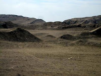
It was up early this morning, the 28th for our second tour of Lima. This one was to view temple ruins of pre-Columbian Peru.
In less than an hour we were southeast of the city and in what could be used as the set for an outer space movie that takes place on a desolate, hot, arid planet. As the bus negotiated up seemingly impossible twists and turns we found ourselves in the midst of miles and miles of gray desert and the ruins of early pre-Inca and Inca temples. Lack of funds has halted most of the excavation and restoration but we were able to see walls, roads, plazas, the Women’s House and a temple to the sun god Pachacamac. The temple and surrounding area are believed to be one of the main pilgrimage centers, similar to Cusco. We climbed over 100 rough stone steps to the top of the temple (most of us did), and were able to take a dusty path down the backside of the temple rather than negotiate the steps down.
Our next stop was a private museum which houses the collection of Larco Herrera. We saw pre-Columbian art, pottery, fabrics, tools, precious metals, ceramic and other relics.One section of the museum was devoted to ancient erotica.
Back to the ship…..we’re beginning to recognize the neighborhoods, one more stroll through the stalls set up on the pier and we set sail at 6 pm for Salaverry (Trujillo).

Friday, February 27, 2009

Feb. 20 ---another one not proof read

February 20 Puerto Montt, Chile

Puerto Montt is the capital of the Lake District (Los Largos) and it was easy to see why. The lakes are huge and numerous. The area has a distinct German flavor as German immigrants came here in large numbers in the 19th century. Ironsmiths, watchmakers, carpenters, brewers, tailor and others contributed much to the development of commerce and industry. Today a large amount of the architecture, music, language , surnames and food retain the German heritage.
While still at home and planning the trip, I pondered long and hard over whether to take a shore excursion to Osorno Volcano and Petrohue Rapids finally deciding not to go because
The excursion was 8 .5 hours long
It involved a 150 mile bus ride, much of it over bumpy roads. That’s 150 miles each way.
3. It required an hour walk up a rough path.
4. It was $139.
However, once on the ship, hearing the shore excursion manager (read salesperson), and seeing the pictures, I decided why not? So off I went at 9 am, leaving Alan to his coffee and pastry.
Once again we traveled on the Pan American Highway---the continuous string of national scenic highways that stretches more than 16,000 miles from Alaska to the Southern tip of Chiloe Island. Scenery on the bus ride was very pretty…..think mountains rising out of lakes, alpine style cabins, picturesque resorts and hotels, lakes with beaches and boat rentals, and checkerboard fields of crops.
After a photo stop at Lago Llanquihue, Chile’s second largest lake, we continued on to Osorno Volcano. At 8,500 feet the volcano isn’t the highest mountain in the area but it’s snow capped peak dominates the horizon. And we were fortunate to have a clear day.
Thankfully, since the excursion brochure had been printed the road had been paved. If you think you have seen switchbacks and hairpin curves, you haven’t seen anything! I can’t imagine what it had been like when it was unpaved.
I guess I hadn’t read the brochure carefully for I expected to trek up the mountain and peer over the edge of the crater into the ashes and whatever else was in there. Wrong.
We were at the base of a ski area….a couple of chair lifts went up (for $10 you could ride the lower on about one-third of the way up the mountain), a simple ski and souvenir shop was at the base as well as a snack bar. A 30 minute walk a short way up the mountain and back down was offered but it was pretty windy and cool up there so I sat in the sun and looked at postcards. Those who walked said the view wasn’t any more spectacular than from my vantage point. But it was pretty spectacular from any point. Both up and down.
It was then on to the Hotel Ensenda, a quaint, charming little hotel. The grounds were lovely (think spring in New England) and the hotel dining room, bathrooms, and lobby filled with every piece of household goods, equipment, farm implement, game, toy, etc., made in the late 1800s and early 1900s. It was like a Cracker Barrel. Only better because they weren’t selling anything.
We had a wonderful lunch starting with the national drink a pisco sour, then a pastry filled with a dollop of melted cheese, salmon with a spinach sauce, tiny boiled potatoes, wine, a wonderful German desert and coffee.
Fully stuffed, we traveled on to the Petrohue Rapids. Road construction and one lane traffic extended our traveling time but once again the scenery was worth the trip. The rapids/falls were not at their peak judging from all the crevices and rocky areas we saw but it was an interesting site. I would guess the park containing the rapids is a very popular place as there were many families and groups enjoying the day.
On the way back to Puerto Montt we made a 20 minute stop at a small pretty town nicknamed the Town of Roses so people could take a picture of a cathedral. I spent the 20 minutes trying to buy a good hand cream. The antiseptic we are required to use before returning to the ship, entering a food line or the dining room is really drying out everyone’s hands. I had no Chilean pesos, therefore no luck. Luckily both Alan and one of our table mates, knew of my predicament and came back to the ship with lotions.
Our bus arrived back at the ship too late for the Folkloric Show, or as it is stated in the daily program, “your local flavor immersion program.” The folkloric shows have been very entertaining and it’s nice to have a short time to chat with the local performers before they have to leave the ship.
And so ended day 50 of the voyage.

Feb. 19 I think

I am so far behind I haven't even proof read this one.

A correction....the rapids were in Puerto Montt...


February 19 Puerto Chacabuco
I wrote up this port several days ago and then lost it. Not that there was much to tell about the town itself. The sail up and back was spectacular as Puerto Chacabuco is at the head of the Aysen Fjord. At one time Puerto Aisen was the only port in fjord but in the mid 1950 a series of fires devastated Aisen. More bad luck followed and in 1960 a powerful tsunami struck the town --- three waves within four hours ---making the harbor unusable and by necessity Puerto Chacabuco became the port.
There is nothing in Puerto Chacabuco but containers, docks and a hotel perched on a hill top. Not a store, not a postcard, not a gas station that I could see. It is, however, the jumping off place to the interior and the Parque Nacional Laguna San Rafael and other natural parks and areas. One reserve is a popular fly-fishing site and a few of the passengers organized a trip to the fishing area.
After tendering in in the very small harbor (it was like a watery cul de sac) Alan and I walked up the two lane road to nowhere (in the rain) until the top of the hill where I quit and went back to the Prinsendam. Alan continued on….but not for long.
We spent a leisurely afternoon doing next to nothing until we went out on we deck for the sail down the fjord which was reminiscent of Norway but not as stunning. What fjords could top Norway’s?
Today we received notice of ANOTHER PRINSENDAM FIRST!
Many cruise ships, including this one, offer a tour of the gallery. They are usually when the galleries are cleaned up and devoid of both food and crew. Interesting but bland. Tomorrow we will have a chance to tour the “back of the house” including the prep-galley, the bakery, crew’s mess room, garbage rooms, provision storage area and more and see where the “soup magic” happens.
We’ve signed up and will let you know what it’s like below the waterline.

Sunday, February 22, 2009

pictures


The rapids at Puerto Arenes


One of the glaciers as seen from the deck of the Prinsendam.


Puerto Chacabuco. I told you there was nothing there.

Charts of a portion of Chilean Straits


hope this is legible.
This one shows when we went out into the Pacific and then back in to Puerto Chacabuco.
The one on the left is more southern.

Feb. 17 and 18

Feb. 17 and 18 Cruising the Chilean Fjords. (I thought they spelled fjords with an “I” in place of a “j” down here but the map says fjords.)
It is 6:45 pm and for the past half hour I have been up on deck and am now looking out our cabin window at the Skua Glacier, also known as the Amalia Glacier. It is a tidewater glacier located in Bernardo O’Higgins National Park. From the Daily Program--
“It originates in the Southern Patagonian Ice Field and from 1945 to 1986
Its terminus retreated four miles making it, along with the receding of
O’Higgins Glacier, the most dramatic retreat of glaciers of this ice field during that period of time.
I don’t know who Amalia was but the Skuas were a wealthy South American family who commissioned a yacht and sailed it to this glacier. Sometime in the late 20th century. It is very frustrating to have bits and pieces of stories but because of the exorbitant e-mail costs, not be willing to google them.
It’s been a quiet day. Lectures in the morning, bridge morning and afternoon and e-mail and blog catching up.
If you’re checking a map (you’ll need a detailed one of Patagonia and the Chilean Fiords) here’s where we have sailed. After leaving Ushuaia, we sailed westward on the Beagle Channel, around the north of Isle O’Brien, through Canal Ballenero, around the south side of Pla. Brecknock, westerly through the Cl. Cockburn to the southern end of Aracena, north up the Canal Magdallena. It was then northwest through Estrecho de Magallanes then north into the Cl Smith and generally northward to Is Esperanza.
For you navigators, directions are approximate.) In the next post I'll try to put in a picture of the chart we have posted on the ship.
Somewhere along the way we altered course to get up pretty close and personal to two more glaciers. Days are longer and we have enough light at dinner time to rush up from the table, run to a window or outside and snap away. Alan was outside for so long, one of the ladies at our table became worried and offered to have one of the men check the men’s room for him. He returned shortly thereafter, safe, sound and dry.
Because the Prinsendam has “soft” propellers, it cannot be backed out of the tight spots the Captain navigates but must be turned 360° and headed back the way we came. Those on the bridge are constantly monitoring the glaciers to make sure there are no great chunks of ice sliding off into our path. The colors in the glaciers are spectacular, all range of blues, with brown of rocks and soils thrown into the mix.
Both sides of all the channels are mountainous, (up to 1,500 feet) faced with sheer rock cliffs and GREEN trees. Some of the tops are snow covered and we’ve seen a few small waterfalls. It is quite a comparision to the pure ice, snow and rock we saw in Antarctica.
We continued up this inland water route until it was no more and we had to go out into the Pacific Ocean for about 6 hours. We popped in again between Isla Rivero and I. Isquiliac .
I have a note on a scrap of paper that at 4:50 pm on Feb. 18 we were at
48° 47.15S, 075° 00.18W. That didn’t agree with what I figured on the chart but who I am to argue with the captain. Besides, they don’t let us up on the bridge. At that time we had traveled 112,702.3 miles from Ft. Lauderdale.

Our route then took us south east to the little coastal town of Puerto Chacobuca.
As the port lecturer and shore excursion people kept tell us….there ain’t nothing there. And they were correct.

Feb. 16, Punta Arenas, Chile

February 16 Punta Arenas, Chile
Rumors abounded all day about our late departure the night before. Two were most prevalent. One, two bodies (not everyone finishes a cruise horizontally) were taken from the ship and the paper work was not done properly. Two, two crew members were caught by the drug sniffing dog with drugs. (Alan later asked the ship’s doctor about the drug story and was told it was not true.)
I can with almost certainty attest to the fact that at least one poor soul left the ship. I was waiting for an elevator and overheard some of the ship’s officers by the gangway talking about getting “his” passport, the procedure, etc. The captain, who we have never seen at the gangway, was also there in his uniform as were the doctor and other officers. And finally, as we were going down the gangway, shore personal were bringing up one of those board things they use for accident victims. At least if you die on board, the captain sees you off.
The captain made good time over night and we arrived only an hour or so late.
We are in the Patagonian Region and our first port in Chile, Punta Arenas, which means Sand Point in Spanish. It is on the Strait of Magellan (he’s all you hear about down here). The climate is very harsh and the area was not easily settled or developed.
Today the main industry is sheep farming, meat processing and wool. Three hundred sheep were originally brought over from the Falklands.
Punta Arenas has a very mixed ethnic culture with a great many Croatians. The four indigenous tribes of the area, the Onas, Haush, Yahan and Alacaluf, were virtually wiped out by explorers and settles and their disease and cultural influences.
The region also had natural gas and the largest methadone plant in the world. I think the guide said methadone. 30% of the cars and taxis in the region run on natural gas.
Before the construction of the Panama Canal the harbor at Punta Arenas was once one of the most important in the world. Now it is mostly used by tourist cruise ships and scientific expeditions but it used to be the last stop for ships provisioning for the treacherous passage around Cape Horn.
Before leaving the Prinsendam we had to fill out a Chilean Declaration form swearing we weren’t bringing in animals, fresh fruits, meats, plants, lab specimens, goods other than personal luggage or over $1,000. We are supposed to carry the form with us at all times when ashore in Chile. Our carry-off bags and backpacks were given a cursory look-over by Chilean officials as we departed the ship.
Alan opted for a HAL tour of museums and the like while I went on a Cruise Specialist tour to the Otway Penguin Reserve.
The bus ride was over an hour…all but twenty minutes of it on bumpy dirt roads. What could be seen out the bus windows was pretty desolate and very, very rural. People who had been inland in Australia said it reminded them of Australia. The bus stopped so we could see emus (or something similar), cattle, sheep, the upland goose, and some native animal whose name I can’t remember. (remember, English isn’t the native language of our guides but they do very well.)
I enjoyed my time at the Otway Reserve but once back on the bus realized I was disappointed in the tour. After walking an hour and a half over a wooden walkway to viewing sites, we saw only a few penguins….probably less than 50. I had anticipated almost frolicking on the beach with thousands. It was explained that the climate changes (down here they don’t say global warming) are changing the breeding and nesting habits of the penguins and many had left the area.
However, our guide was very good, the people on the bus friendly and fun, and we made a quick pass through the town before returning to the Prinsendam.
Alan returned from the tour he took-----museums, the town square and a cemetery to rival the one in Buenos Aires. Well, almost.

Wednesday, February 18, 2009

Feb. 15


Previews of pictures for Feb, 16
Punta Arenas. Penguins on beach, sign you probably can't read.

February 15 Ushuaia/Tierra del Fuego.
No one agrees on the pronunciation. Most say You Shway ah.
Ushuaia claims to be the southernmost city in the world. Imagine my surprise when one of the first things I saw after getting off the ship was a bed of pansies. Of course it is summer down here. A balmy 50 degrees
Ushuaia once was the location for an Argentine prison for serious criminals. The site was chosen as escape was virtually impossible. A railroad was built by the forced labor and today is a tourist attraction known as Tren del Fin del Mundo, Train at the End of the World.
After our catamaran cruise in the Beagle Channel (more later) we had about an hour to wander the town. I’ve never been to Alaska but Ushuaia was what I think of when I think of Alaska. The town had a definite “frontier” feel to it. Other than the obvious cruise ship passengers (think blue fleece jackets) and backpackers (think long hair, beards and proper clothing), most of the people in the streets looks Indian, with darkish completions, and dark straight hair.
The streets went uphill from the docks. Many of them had a series of steps built parallel to the sidewalk so if you wanted you could walk steps instead of the incline of the sidewalk. As you can imagine, most of the souvenirs in the shops proclaimed that we were at the end of the world. Once again, all we bought was a post card.
The Beagle Channel.
Our Cruise Specialists Shore Excursion left at 11 am or so and after a short walk down the pier we boarded a motor catamaran for our 4.5 hour cruise. The boat was very comfortable and easily accommodated our group with plenty of extra seats. Alan opted for the upper deck and stayed outside most of the day. The rest of us alternated between the warmth of the cabin and the outer decks. The temperature was in the high 40s and sunny so it was quite comfortable even with the breeze/wind on the decks.
Our guide was very knowledgeable and kept us informed of the species of birds and seals we were seeing. The boat was able to get very close to shore --close enough for us to smell the seals. We were served coffee, tea and cookies (those on the HAL tours weren’t).
After a couple of hours we arrived off a house, shed and dock on what looked like a small island. Out came a small boat powered by an outboard engine. It brought the postmistress who once safely onboard proceeded to give us all a free stamped post card, and a “ passport’. We all wrote our cards (we were able to buy extras from the catamaran as well as stamps from the postmistress), she cancelled them, and collected them in a sack for mailing from the local post office. (HAL tours didn’t get that service either.) I wonder how long it will take for postcards to get to Massachusetts from the end of the world.
We saw birds!!!!! And seals!!!!! And more birds! And more seals! And a lighthouse. And a tiny rusted bit of a shipwreck.
The next day our neighbors across the hall laughing told us that on their HAL tour they approached a rocky island and spotted hundreds of penguins. After taking about 200 pictures (their estimate), some of the penguins flew away. Well……penguins don’t fly. What they were seeing were blue eyed cormorants. They are similar to our northern hemisphere cormorants but are black and white like penguins. Hopefully, I’ll be able to post pictures of the cormorants and seals.
After our boat trip we wandered the little town for the hour we had left and returned to the Prinsendam for the 5 pm departure.
At 5:15 the cruise director came over the PA system and announced that we were almost ready to leave but a couple of people had not yet returned….one of them being the captain. It seems there was a little paper work to clear up.
At 6:00 another announcement --virtually the same. And at 6:30 with the added comment that it was a Sunday and almost nothing official gets done on a Sunday in Ushuaia. Finally about 8 pm we left the dock.
And thus ended day 45.

Feb. 14


pictures above left to right....seals in Beagle Channel, cormorants in Beagle Channel, just a little of what we saw in Antarctica....
I just noticed that there is no Feb. 13. I'll have to check it out .....after all it was Friday the 13th
Feb. 14, Valentine’s day At Sea
Day 44
Today is a bit rough. I was able to stay in the Queen’s Lounge for only a small part of the forum by the Captain, the Ice Pilot and our Expedition Leader as they told about the construction of the Prinsendam (not built for ice), maneuvering around the icebergs, etc.
The Expedition Leader, John Splettstoesser has been wonderful on the bridge as we cruised in and out of icebergs and glaciers. He gives names to places and facts on the wildlife. In addition, he has given several talks on life in Antarctica.
Yesterday we saw one or two small cruise ships that take less than 100 people and are small enough to get in closer to the shoreline. On some of the smaller ships, passengers are allowed ashore ----under strict conditions of course.
Because of the sea conditions, the Captain’s Valentine’s Day Ball was postponed. It wasn’t rough enough for people to take to their beds, but dancing would have been a little rocky.
It’s hard to believe that I can’t write much about the last three days as we have been awe struck by the scenery….wildife….and overall experience of Antarctica. Even the air has a sharpness and clarity to it that we don’t often see.
What we have seen in the past few days has been beyond belief. Did I mention that the ship showed both the March of the Penguins and Happy Feet this week. We could really relate to them. We could actually recognize the various species of penguins and birds in Happy Feet.

Thursday, February 12, 2009

three at a time seems to work


ice berg rusted tanks on So. Georgia Abandoned whaler on S. Geo.
Can you see tiny spots on the iceberg? If I used the correct picture they are penguins.

Hopefully pictures


If pictures post give thanks to the wonderful fellow who is in charge of the internet on the ship.
left to right. molting seal. molting penguin, little fur seal

Feb 11 At Sea

February 11 At Sea
Our position at 2:26 pm whatever time zone we are in.
62° 27.15S 56° 20.40W
Seas 4 - 7.5 feet
Air temp 35.6° F Relative humidity 100%
Wind 5 knots from the east across the deck
Day 41 of our journey. 10,731 miles traveled since Ft. Lauderdale
871 Miles traveled from South Georgia
1,222 Miles to go to our next port Ushuaia ( no one agrees on the pronunciation but most say You shy ah) It’s the southernmost city in the world. Anyone need a stamp?
Next sunset 8:25 pm
Next sunrise 4:58 am
Ship’s heading 220.1
Ship’s speed 13.3 knots
Our daily program is headed OUR ANTARCTIC EXPERIENCE BEGINS. What it doesn’t mention is that we are surrounded by thick fog with little chance of seeing anything until it lifts.
I’ll just have to fill the time with telling you about Antarctica, the southernmost continent. It is 5.4 million square miles, making it the fifth largest continent. 98% of Antarctica is covered with ice and it is the coldest, driest, windiest continent on Earth. It has the highest average elevation of all the continents and the interior because of it’s lack of precipitation is the largest desert on earth. There are no permanent residents. However, more than 4,000 scientist from all our the world are currently conducting research experiments on Antarctica.
No one owns Antarctica although many nations have claimed it. The 1959 Ataractic Treaty prohibiting military activity and mineral mining has been signed by 45 countries.
I just realized that we will be in Ushuaia on a Sunday. I wonder if the post office is open. Our shore excursion takes us there.
It is now 5:45 and we’ve had much going on since I started writing earlier this afternoon.
I was sitting in the cabin writing this blog when an announcement came over the pa system. "Iceberg on the port side."
I hadn't realized the heavy fog had lifted but it had so I quickly put on a jacket, socks, sneakers, hat, and gloves, grabbed the camera and rain up the stairs to deck 7. As I came panting around the corner from the stern.....there it was
A very large flat topped iceberg right beside the ship. Everyone was taking pictures, some people had even run outside without putting on jackets. IT WAS COLD. AND WINDY. WITH SNOW FLURRIES. I took plenty of pictures and went back to the cabin to get rid of the outside clothes and get a cup of tea to warm up the icy hands.
Fortunately, I kept the camera with me because a second announcement came through about our next iceberg. The fellow making the announcements said the captain would turn the ship so both sides would have a view. (I guess some of the passengers can’t or don’t want to walk to the other side of the ship.)
We were told this the second iceberg had a brown area on it….a sign of penguins.
Sure enough, as it came closer we could see many, many little spots develop into many, many big penguins.
Now, as I write this, icebergs of all size are floating by the cabin window. No announcements. Just one that the officers on the bridge were busy watching for growlers, the pieces of ice that break off the larger iceberg. I suspect that by dinner tonight, no one will even look out the windows, let alone take pictures.
The captain will take the ship as far into the waters of the Antarctic Peninsular as he feels is safe, then turn around and head toward Yankee Harbor and Half Moon Island.
Later: I was wrong. At dinner we all spent the evening swiveling ours head to look out all the windows at the icebergs silently floating past
The evening entertainment was the movie Happy Feet. It meant so much more now we have seen the glaciers and icebergs and could identify the penguin types, the seal and birds.

Feb 9 and 10

February 9 and 10 At Sea

The laughs just keep coming. Yesterday, the Captain came on the loud speakers for his mid-day address. He started off with his usual, “Hello, it me again. Our noon position was” We then had about a minute of dead air with everyone smiling and laughing until “ah, here it is…..the position is--------“followed by whatever it was. If you’re not smiling, I guess you had to be there.
My morning started off with a bang. Or a blast. Alan was off to breakfast and I had just gotten out of the shower and dressed when the fire alarm whistles went off. I’m pretty proud of myself. I changed out of sandals into socks and sneakers, got the life jackets down from the closet shelf and opened the door to hear the announcement. While I was wondering if Alan would come back to the cabin for a jacket and hat, and whether I had time to get the safe open and get out my little bit of good jewelry, the Cruise Director came on and announced, “This is a drill for the crews. This is not a real emergency.”
It appears that there was an earlier announcement to that effect but I didn’t hear it in the shower. I had to wonder how many late sleepers were jolted out of bed by the alarms.
About 3 pm an announcement came from the bridge that whales were spotted on the starboard side. About a dozen people went out to look. Me included. No whales. Fifteen minutes later…..“whales ahead, dolphins on both sides, seals on the port.” I grabbed my jacket, the binoculars, and a camera and went to the bow area. After 15 minutes, two sightings of whales blowing, I went inside with a new respect for the whalers who stood for hours in the crow’s nest. Off I went to tea and while sitting with my scone and tea cup what went by the window than more seals than I could count.
Tuesday, Feb. 10

Today is very foggy. Very, very foggy. We’re traveling at a slower rate of speed, looking out for ice bergs, I guess. Everyone is hoping it will be clear by early tomorrow morning as we want to see Elephant Island in the distance.
Here’s a little about penguins.
Early Antarctic explorers thought penguins were fish and classified them as such. We now know they are birds, superbly designed for flying underwater. The breastbone makes an excellent keel and with massive paddle muscles they can swim at speeds up to 25 miles an hour. Their heads are a perfect hydrodynamic shape. When swimming, penguins can leap out of the water every few feet. This action, porpoising, enables them to breath and helps them escape from predators. Sometimes.
There are 17 species of penguins. Only four breed in Antarctica: the Adelie, the Emperor, the Chinstrap and the Gentoo. Some species spend as much as 75% of their lives at sea yet they all breed on land or sea ice. Some species can reach depths of 1000 feet or more and stay submerged for up to 25 minutes.
Believe me, it’s hard to follow them when they dive as they come up every where but where you’re looking.
It is estimated that on South Georgia there are over 450,000 pairs of King Penguins, 12,000 pairs of Chinstrap Penguins, 22 million Antarctic Prions, 77,500 Wandering albatrosses, 10 yellow billed teals, and 3.8 million common diving petrels. There are a few reindeer, ancestors of the herds introduced from Norway for food and hunting.
End of lesson.

Tuesday, February 10, 2009

pictures from South Georgia

I can't get the pictures to post. I'll try later. Sorry. The seals are really cute.

Feb. 8

February 8, Cumberland Bay, South Georgia
Where to begin?
First with a correction. I think I mentioned that we would be seeing sea lions. Wrong. It should have been elephant seals.
Once again, we’ve cast off our role as tourists and become part of an expeditionary force.
We’re about to embark on a once-in-a-lifetime experience (unless you’re a scientist you will probably never get to South Georgia.) Here’s what we’ve been told in our daily program.
Required: A sense of adventure!
This is not a “port of call” in any traditional definition of the word. You are about to experience an “expedition” call on South Georgia. Grytviken is not “improved” nor does it have terribly friendly terrain. MANY hours have been invested, both here on the ship and on the island to prepare for our arrival. It is, however, the inevitable “unknown factor”….what we cannot foresee….whether it is weather, wildlife or other force of nature that can affect these plans.
Our tender operations will not be business as usual. FLEXIBILITY is the name of the game. Everyone who wishes to and is able will go ashore. Be realistic about your abilities.
Combine that with the instructions we received a day or two ago and we were wondering what we were in for.
We started off by seeing ice bergs ----large ones. Then seals swimming past the ship. And then we sailed into Cumberland Bay---probably one of the most beautiful, awesome, desolate places we’ve seen. No trees, just cliffs of ice and rock, fields of tussock grass, a tiny, white, quaint church, abandoned, rusted fuel tanks and equipment, and rotting piers and derelict half sunken ships.
And PENGUINS, AND FUR SEALS AND ELEPHANT SEALS. It was impossible to stay the requisite five years from the penguins and seals as they littered the beach, slopes and rough path. As we approached the small cemetery on the hill, the smell from the elephant seals greeted us. And what a smell! I’ll leave it to your imagination as to what caused the smell.
It is molting season so the penguins and seals are quite lethargic. We were happy for this for when they opened their mouths to yawn their teeth were very, very big.
And pointy. And sharp.
We were extremely lucky. The weather cooperated and instead of snow, wind, rain or extremely cold temperatures, we had a little wind, partial sun and temperatures above freezing., Our fluffy fleece jackets from Holland America were almost too much. We ended up taking off the gloves in order to take pictures and our hands were quite comfortable.
I’ll let the pictures tell the story. Whenever and however I can get them posted
The whaling station at Grytviken is no longer. It has been allowed to blow away, rust away and crumble. Slowly the storage tanks are being drained, metal roofs have been removed due to the danger of them flying off, and the rest of the place left to revert back to nature. Of course, it never will. The only people there are a dozen or so scientists who lead a very cold, lonely existence.
Only the captain can say Grytviken like he isn’t struggling. But after all, he’s Norweigan. Phonetically its Grits veek en.
Sir Ernest Shackleton’s epic journey took on new meaning when we saw the rugged, unforgiving mountains he crossed in his final effort to rescue his men. We’ve been reading many of numerous books on his ill-fated expedition. Most have astonishing photographs taken by a member of the crew. I found a very small volume in the library here called Escape from the Antarctic by Ernest Shackleton. It is published by Penguin Books and is an excerpt from South, the Endurance Expedition. It takes about an hour to read and I highly recommend it. Hopefully, you will be able to visualize the terrain and terrible seas.
Here’s a bit from the book I liked. It sounds like Shackleton had a sense of humor, even under conditions that would make most of us just curl up and hope to die.
When the James Caird (the small boat they hoped to sail to South
Georgia) was afloat in the surf she nearly capsized among the rocks
before we could get her clear, and Vincent and the carpenter, who
were on the deck, were thrown into the water. This was really bad luck,
for the two men would have small chance of drying their clothes
before we got under way. Hurley, who had the eye of the professional
photographer for “incidents” secured a picture of the upset, and I
firmly believe he would have liked the two unfortunate men to remain
in the water until he could get a “snap” at close quarters; but we
hauled them out immediately, regardless of his feelings.

As we were leaving Grytviken, I looked down and there was Alan unknowingly breaking the law. (Did I mention that we had to sign a form saying that we had read the rules and would abide by them?) Sometime during his trek through the grass his sneakers and socks had picked up some type of large round burrs. Fortunately we noticed them and he was able to pick and scrap them off.
While Alan was de-burring we noticed two members of the medical staff sitting on the dock beside medical bags and stacks of emergency food supplies. It was a strange assortment-----bottles of water (I can understand that) but dozens of large cans of peanuts, cases of Twix bars, cans of pear halves and things we couldn’t figure out? If the picture gets posted, take note of the Publix bag.
We now begin a week of sailing into Antarctica.

Saturday, February 7, 2009

Feb. 5, 6, 7.

February 5, Stanley, Falkland Islands
We were told by many people that there was nothing to see on the Falkland Islands. In fact, the joke on the ship told in an incredulous tone was “England gave away Hong Kong, and fought over the Falklands?”
If it wasn’t for the war between Great Britain and Argentina in 1982, most of us probably would have no idea where the Falklands are. During the 77 day war the island was heavily mined by the Argentine forces, and mines still remain, along with warning signs.
The Falkland Islands are made up of 33 islands, two of them large. There are about 3 thousand people living on the islands, 1800 of them live in Port Stanley. The archipelago is approximately 500 nautical miles northeast of Cape Horn and about 350 miles off the coast of Argentina. All land beyond Port Stanley is referred to as “the camp” and the majority of the people in the camp are sheep farmers. Strangely, Stanley observes daylight savings time in the winter but the camp does not.
We arrived later than scheduled but earlier than we would have had not the captain changed course yesterday and pushed the Prinsendam for all it was worth. Sailing in we were reminded of Cape Cod….white sandy beaches with scrub vegetation on dunes. The comparison ended there as the Falklands have large outcroppings of rock.
The Amsterdam was anchored in the bay when we arrived having just sailed up from Antarctica. We were ashore by 11 and began to walk Port Stanley. I don’t know why people said there is nothing here. It is a charming town, with narrow streets, English looking houses with flower gardens in the front yard and vigorously growing vegetable gardens in the back, plenty of pubs, gift shops and a decent size market. There are no native trees…..but several very large imported ones around the cathedral. The Anglican Christ Church Cathedral is the southernmost cathedral in the world and was quite impressive being built of brick and wood. Outside the church was an arch made of whale’s jaw bones.
We had a slight mishap shortly after beginning our stroll down the main street. Alan didn’t see the change in level between the sidewalk and the street, took a step and went flat on his face, breaking his fall with his nose. I was walking ahead of him, heard a thud but didn’t look back until people started gasping. Turned around and there was Alan sprawled face down in the street. Motionless. He must have had the wind knocked out but as people tried to help him, he managed to get to his feet. Luckily there was a bench outside the shop so he sat down. Within seconds a woman had handed me a packet of Neosporen, a man an alcohol wipe and another woman a Band-Aid. Or a plaster as they call it in this English town. A tissue took care of the blood and we continued on.
(several hours later: the nose is swollen, scratched, and raw looking with newly formed scabs and the left knee a little scratched and a lot swollen. It could have been a lot worse. Alan is soldiering on with his favorite pain killer.
Many of the roofs are painted bright orange, red or green making a very colorful approach from the sea.
We took a local tour to Gypsy Cove and after a 20 or so minute ride over the bumpiest roads you can imagine there they were -----the penguins. Three people kayaking in the waters below us were joined by three dolphins who stayed with the kayaks for quite a while. We saw the penguins only from a bluff (and behind ropes and land mine warning signs) but people who took other tours saw them up close and personal….within a few feet. Hopefully, we’ll get that opportunity later.
The ranger at Gypsy Cove told us the penguins we saw were youngsters waiting for the parents to come back and feed them. According to him, the penguins are getting their “oily feathers” early this year. Once they have all this type of feather they will take to the water.
There are several penguin species. We saw the Gentoo and Magellanic. We also saw Geese, (not Canadian), ducks and the albatross.
February 6 and 7 At sea
It’s getting colder. People are now dressed in sweaters, socks and even hats.
Only a few hardy souls are out on deck…and the wind is blowing!
I’m off to a mandatory lecture on South Georgia. In Brazil we were inundated with warnings about pickpockets…..now it about not touching the wildlife, staying on the paths and not taking anything ashore. Or anything off the island.
.
This is the last year that ships with more than 500 passengers will be allowed to go to land passengers on South Georgia Island in Cumberland Bay. The new regulation is in effect but the Prinsendam is being allowed to send passengers ashore because the cruise was booked before the new regulations.
Here are our instructions.
No wheelchairs and walkers are permitted ashore. You will be assigned a departure time for your tour. Changes will not be allowed. At any time the local authorities can change the content or duration of our call on South Georgia without warning. Your group will have at least two Prinsendam crew members as leader -- they are not guides and are with each group as a requirement of our visit to ensure everyone stays together and follows designated paths.
There are no restrooms ashore.
There are no medical facilities.
Smoking is strictly forbidden on the island.
It is strictly forbidden to take food ashore.
Groups must stay at least 5 yards clear of all wildlife.
Guests are not allowed to stray from the group and group leader.
Guests are not allowed to stray from the paths/tracks.
Guests are not allowed to go ashore unless on an organized complimentary tour.
Rocks, plants and artifacts should not be touched.
Please ensure that your footwear is scrubbed in the boot washing station, removing all soil and organic material before going ashore.
Inspect all of your clothing for soil, seeds, and insects, especially cuffs, Velcro pockets, seams and hoods. This includes walking sticks, ski poles and camera tripods.
Empty, vacuum and inspect inside all bags that you take ashore to ensure the absence of soil, seeds and insects.
In the remote chance the weather turns severe
Carry three days worth of medication..
It can be extremely cold, windy and possibly wet. Wear warm waterproof clothing and good footwear.
At any time due to a sudden change of weather, the tenders may stop operating, so in that even and the remote possibility of staying overnight, the ship and local personnel have organized an emergency contingency plan. However it will be a Spartan experience --lodging and food wise.
Now doesn’t that sound like a fun trip!!!!
Actually, it is rare experience to be allowed onto the island. Here’s a brief description and history.
It is long and narrow and everywhere the snow covered mountains rise straight from the water, reaching near the center of the island, to a height of over 9,000 feet.
1676 South Georgia sighted by a British merchant
1756 Second sighting by the Spanish
1775 Captain Cook lands in Possession bay and claims So. Georgia for England
1786 Sealing industry begins
Plenty of history but we’ll skip to
1904 C.A Larsen of Norway establishes the whaling station at Grytviken and the whaling era begins.
1916 Sir Ernest Shackle ton and five companions reach So. Georgia from Elephant Island. (great book with plenty of pictures--The Endurance, Shackle ton’s Legendary Antarctic Expedition by Caroline Alexander.)
1922 Shackleton ides on board Quest at Grytviken. His body starts the journey home but his widow notifies the ship that he wishes to be buried at Grytviken so he is taken back and buried there.
1965 Closure of the last shore based whaling station in South Georgia.
1982 Argentine military forces occupy South Georgia for 22 days. Some land mines are still on the island.
2009 Alan and Sandra visit South Georgia (we hope…..last report---it’s snowing there.
We have just received a notice that there may not be satellite service in South Georgia or Antarctica so if you don’t hear from us we’re out consorting with the penguins.

Thursday, February 5, 2009

Feb. 3 and 4 At Sea


samba show
cemetery
February 3 and 4. At Sea
A chance to sleep in and most people do. The Lido is pretty empty until about 9 am. Our table of eight is back at full strength. One couple had been off overnight to visit relatives in Montevideo, one for a 14 hour trip to Iguazu Falls ($1299 per person) , and one gone 4 or 5 days to do his own touring.
Our friends Kate Ross and her husband Carl have left to return to Rochester, NY. Kate was an Exploration Speaker and her stint aboard the Prinsendam is over. They were not looking forward to Rochester’s snow. About 80 new passengers came on board and close to a similar number left. We’ve picked up a little child. An adorable little girl about 3 who is accompanied by her parents and what looks like a grandmother. She’ll be the darling of the ship.
During one night, accompanied by spectacular lightening we had heavy, heavy rain. As the story goes, the drains on the 12th deck were clogged so the water ran down onto deck 11. The pool flooded and overran its sides. One side of the Lido dining room was flooded so they removed all the furniture and brought in the wet vacs and fans. We talked to a couple whose cabin is under the Lido and they had an impromptu and unwelcome shower from their cabin ceiling. They were offered another cabin until theirs dried but decided it was too much bother to move their stuff. Other than the noise from the fans, they don’t seem too distressed.
Last night we received heavy blue fleece jackets for Antarctica. They are very nice and have sleeves that zip off to form a vest. We’re waiting to see when the first one appears on deck.
The captain announced yesterday that he “steaming” at full speed but only traveling at 18 knots because of the strong currents. Today he came on and said he has changed course and we’re traveling at 22 knots but will be an hour or so late arriving in the Falklands. We’ll stay an hour later than our scheduled departure and then head toward Cumberland Bay, South Georgia. And Shackelton’s grave. Few ships are able to anchor at Cumberland Bay but our captain is Norwegian and Shackelton one of his heros so we stand a good chance.